

I kind of assumed most people working on Google maps are car first people, and the transit stuff was a second class concern. This isn’t based on any facts, just a gut feeling.
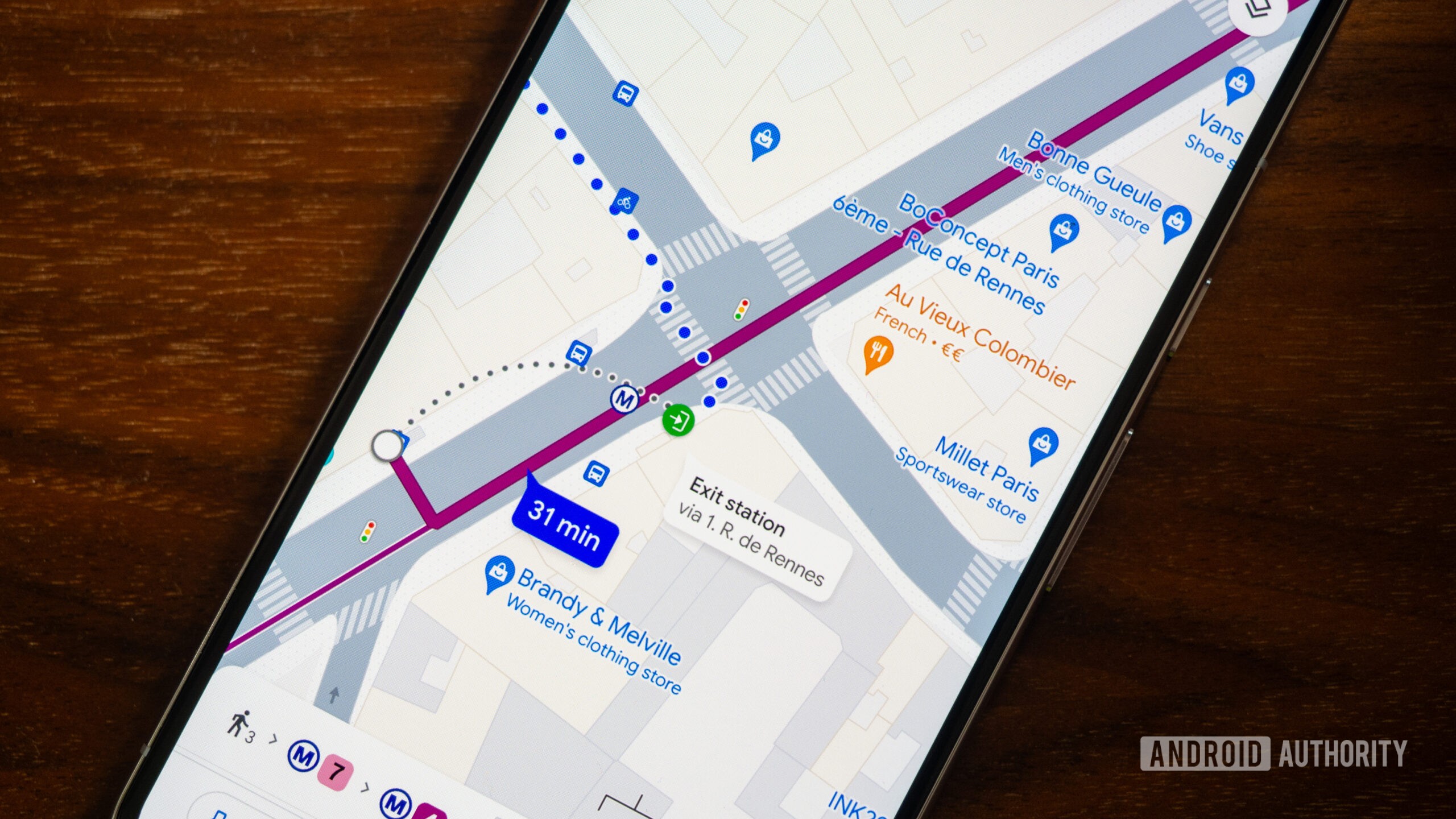
The most annoying things for me are how it’s kind of hard when looking at the map to see what stops are where. Like, I have to fuck with the zoom to get it to show me DeKalb Ave is there, and then it doesn’t even tell me which trains stop there.
And forget about getting any useful bus info. I know generally where the b41 goes. Why isn’t it easy to see on the map?
Well, yeah, just look at the latest Google Maps update. The new maps layer overemphasizes highways with high contrast. Even places like Amsterdam. Doesn’t matter zoom level. If you are not getting around by a car, everything is low contrast shit.
Weirder still is that they emphasized highways but always make people drive through small residential neighborhoods, back alleys, and parking lots to save a minute or two.
I need a maps alternative that focuses on keeping me on roads meant for actual through traffic.
OSMand tends to choose a much more intuitive route.
Yes, it’s so freaking annoying that I’ve to constantly fiddle with zoom levels just because I want my fucking map to show me the names of the stations and streets. I guess the technology isn’t there yet. But somehow, Google has figured out how to constantly display the names of businesses which have paid them.
Anyway, I’ve been using more and more of Open Street Maps with the Organic Maps app, and it’s a refreshing experience
Is your feeling based on the fact that you can only get driving directions offline (not even walking!)?
These all seem like nitpicks. Maps transit is still the best way to figure out to go between points and it works in multiple countries with the same interface.
Yea, like, basically the complaints boil down to, why am I not being handheld throughout the process more?
For me I just need the general direction and what bus/train line direction to take.
Feels like people in general are getting worse at basic spatial awareness.
The missing features are very basic things, like showing stops on a map or which location within the stop the bus stops at.
That’s just missing data, I don’t have that issue at all.
And to be fair, it’d be cool if these - comparatively small - changes happen. But using transit routing frequently here, I have no real complaints with it. It works fine.
deleted by creator
It’s quite decent in the UK. But I wish it had more customisability. Sometimes it cannot understand that I’d rather walk 15 minutes than buy a bus ticket for a 3 minute bus ride. But if someone was disabled and got free bus rides because of that, then of course it would make sense for them.
It can tap into bus data to see when it’s late and stuff. But sometimes the bus company messes up the data. Oops.
Great in Poland, too. With live vehicle location and shit
It also can’t support intermediate destinations via public transport (for example wanting to get somewhere via somewhere else)
Google Mapstransit is still a frustrating experienceIn most European urban areas, it’s not more frustrating than driving.
Really really depends on the situation
Try the Transit app, by Transit,inc…
It’s a lot better than anything out there, as long as your area is supported.
Transit is the best! Every once in a while I attempt to go back to Google Maps hoping it’s approved and then immediately run back to Transit.
If I didn’t have Google Maps Transit to navigate western Europe, Singapore and even Los Angeles I’d be completely screwed because I come from a country with next to no public transport and had no idea how it was meant to work
One of the routes I take tries to get me to make an illegal crossing through a busy street to get to a bus shelter on the other side.
A short walk down the sidewalk, there’s lights with a crosswalk. And just on the other side there? A much safer to access bus shelter that the same bus stops at.
There’s seemingly no way to report this stupid route, either.
I usually check navigation on both google maps & citymapper and follow the one that give the most sane directions.
That’s why we need openstreetmap. Its made by people in the community so it is as good as the people who use it.
Is it worse than the alternative? I’m no Google loyalist these days, but if you’re like me you have no idea what the alternative transit guide even is!
Open Street Map. If something isn’t accurate, you just update it like Wikipedia. I made some updates to my city, and now it works flawlessly
I use the app’s by local transit services and organisations (9292, NS) and so far that’s working out pretty well.
They don’t have the reminder to indicate when your stop is coming up, but the last two or three times I tried to use that with Google Maps it just didn’t warn me, so I don’t think I’m missing out on much.
There are a bunch of open source transit apps as well, but little work as well as Google does when it comes to planning trips and finding alternatives. Sometimes there just isn’t any open data about public transit and only a few shitty commercial apps have up to date information, but you could always check Google if the routes they suggest seem inefficient or too good to be true.
I almost exclusively use the app called Transit. It uses OSM data and shows live tracking for buses and trains (at least it does in my city). It’s good for figuring other options like walking, cycling, bike share.
Try the Transit app, by Transit,inc…
It’s a lot better than anything out there, as long as your area is supported.
Citymapper is the gold standard. Osmand is excellent, except for delays. Many countries have third party top-tier apps for transit and train navigation – Trainline comes to mind in the UK, but it varies by region.
It’s still the best experience for me because it’s the only one.
Stop using google
What do you recommend instead for transit?
Google Maps lets me know when to get off my stop, and where to head next, in real time, as well as updates on whether metros or trains are late and when the next one is coming.
Google in general, no just maps.
For a maps solution OSM.
Does OSM support turn by turn navigation with live traffic / public transit updates?